[ad_1]
Google Maps users planning journeys in several major cities will soon be able to see an AI-powered preview of their driving, walking, or cycling route.
The new feature, which expands on Google Maps’ existing 3D immersive views of neighborhoods, landmarks, and businesses, will enable users to familiarize themselves with travel routes, including features like bike paths, and see a 3D preview of expected traffic and weather. That, says Chris Phillips, VP and general manager for Google’s Geo team, will let travelers better plan for their upcoming journeys.
“You can familiarize yourself—like, what’s the bike path like,” he says, speaking in a Google press event Wednesday. “If you understand it’s going to rain, maybe you go now.”
Immersive route planning, which will be rolled out starting this week in cities including New York, London, Paris, San Francisco, and Las Vegas, is just one of several AI-powered Maps features the company is adding or expanding. “AI has really supercharged the way we map,” says Phillips.
Google Maps’ search function is also getting an AI enhancement, with the company harnessing computer vision to find matches for queries based on images uploaded to Maps as well as text reviews and descriptions.
For instance, says Miriam Daniel, VP and GM for Google Maps, a search for “animal latte art” could pull up nearby coffee shops where users have uploaded photos of creatively decorated beverages. Maps is also adding enhanced support for broader queries, like “things to do” or “restaurants,” organizing search results into categories, like “art exhibitions” and “anime” for users looking for activities in Tokyo, she says.
Users looking for information about amenities in their immediate vicinity will also soon be able to use the augmented reality feature called Lens in Maps, previously known as Search with Live View, in more cities, including Austin, Las Vegas, Rome, Taipei, and Chicago. The feature lets users point their iOS or Android cameras at a building or other site to learn about businesses, restrooms, ATMs, and other useful facilities there.
People using Google Maps in the car in the US, Canada, and several other countries will also see more detailed information on many drives within the next few months: The app is providing more detailed images of buildings along the route, as well as enhanced information about highway lane changes and exits to avoid last-minute navigational surprises.

[Image: Google]
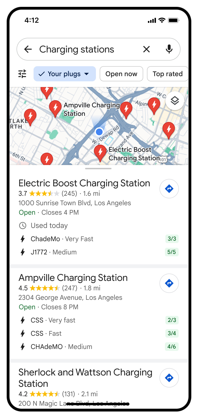
Electric car drivers will also soon find more detail about chargers near them, including information about charging speed, plug type, and when the charger was last used, which Phillips says can help people avoid visiting chargers that are out of order.
Google Maps is also continuing to add information about fuel-efficient routes, as well as features like HOV lanes, in new locations. In general, Phillips says, Google Maps sees 50 million updates every day, thanks in part to a network of 300 million users who contribute information to the platform.
“We like to talk about the map as always alive,” he says. “Think of it as always changing.”
[ad_2]
Source link

