[ad_1]

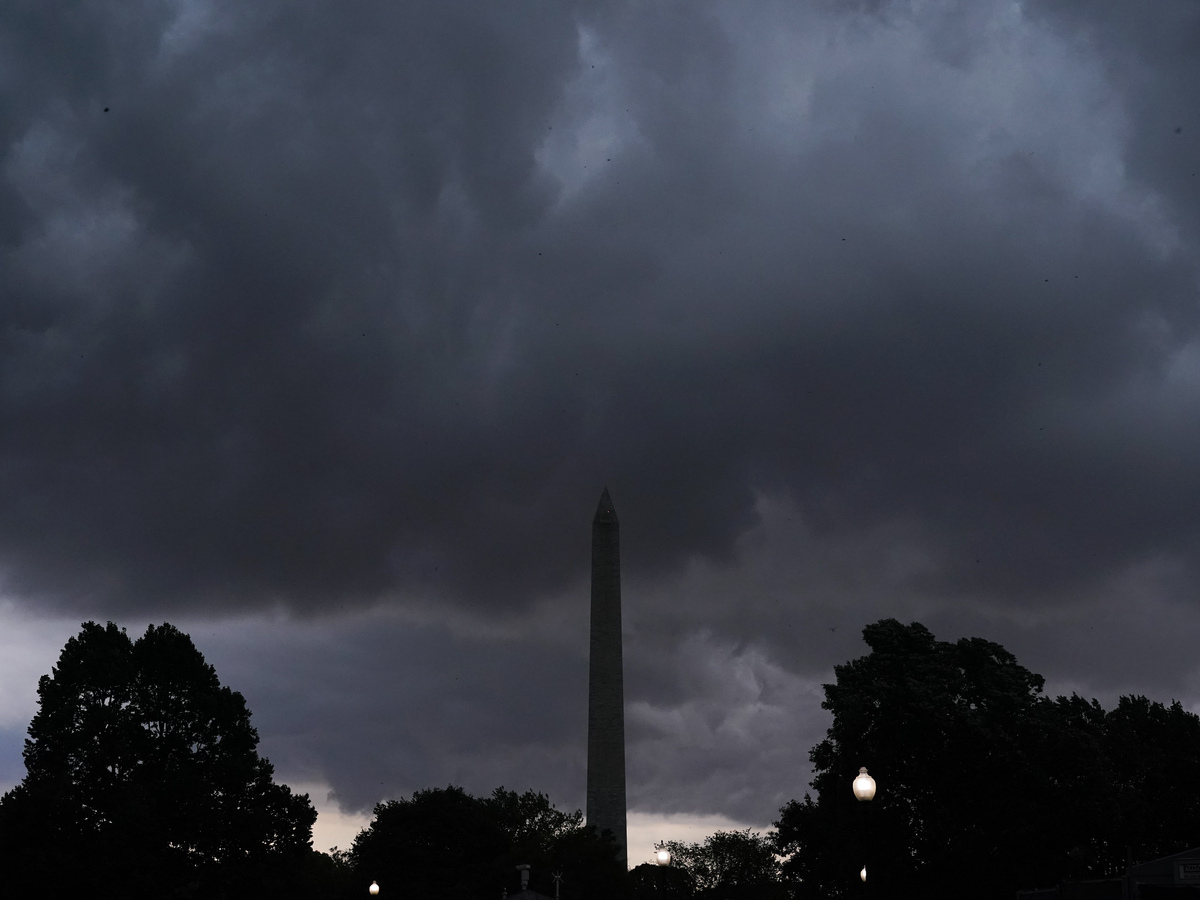
Storm clouds darken the sky over the Washington Monument on Monday after thousands of federal employees were sent home early amid a tornado watch in the Washington, D.C., region.
Jacquelyn Martin/AP
hide caption
toggle caption
Jacquelyn Martin/AP

Storm clouds darken the sky over the Washington Monument on Monday after thousands of federal employees were sent home early amid a tornado watch in the Washington, D.C., region.
Jacquelyn Martin/AP
A severe summer storm that swept across the eastern U.S. on Monday took the lives of two people, left millions without power and caused flights in nine major airports to grind to a halt.
Photos and video from nearly a third of the country show toppled trees, felled power lines and damaged buildings as a torrential mix of strong winds, heavy rain — and, in some places, hail, lighting and flooding — barreled from Alabama to New York.
By Monday afternoon, a widespread tornado watch was in effect for more than 29.5 million people, according to the National Weather Service (NWS).
Local officials reported two deaths related to severe weather
In Anderson, S.C., a 15-year-old boy was struck and killed by a falling tree, the local coroner’s office confirmed to NPR.
Police in Florence, Ala., said a 28-year-old man was also killed Monday after being struck by lightning in a parking lot.
By early evening, more than 1.1 million homes and businesses were without power across a chunk of the country stretching from Alabama to Pennsylvania, according to multiple news outlets, citing poweroutage.us.
As of Tuesday morning, that number had dropped to just over 333,000, with Pennsylvania and North Carolina seeing the greatest impact.
In Westminster, Md., a row of power lines toppled onto a major thoroughfare, trapping 47 people, including 14 children, for up to 5 1/2 hours. State authorities said no one in the 34 impacted vehicles had been injured.
Tornadoes left trails of damage in Indiana and New York
More than 250 reports of strong winds were made by weather spotters in the Southeast and mid-Atlantic, according to the NWS. Forecasters in Philadelphia and New York warned residents that winds could gust up to 70 mph throughout the respective cities — a condition that left a high risk of life-threatening currents, including rip tides, across New York’s beaches on Tuesday.
Trained spotters in Maryland and Virginia registered hail the size of a baseball (4 inches), which may be the largest reported in the region since 2002, according to local storm chasers.
Federal employees in Washington, D.C., were asked to depart their offices early to avoid driving during a tornado watch for the region — just a day after a severe thunderstorm watch disrupted travel and sparked chaos amid a crowd of thousands at a Beyoncé concert.
The district didn’t report any tornado sightings in the end, but a tornado did touch down briefly in Indiana’s Dubois and Orange counties on Monday, according to the local NWS office.
Aerial video of the town of Paoli, Ind., showed roofless buildings and bent traffic signs, victims of hurricane-force winds.
Another tornado was reported by local media Monday evening in McGraw, N.Y., but the extent of the damage was not immediately clear on Tuesday morning.
An apartment complex and gas station in Knoxville, Tenn., also lost their roofs, according to photos and reports from the Knoxville News Sentinel, but the culprit appeared to be strong wind.
Tuesday’s forecast could bring heavy rain to the New England region
Nine major airports, including those near Atlanta, Washington, D.C., and New York, came under a ground stop on Monday, according to the Federal Aviation Administration.
By the evening, more than 2,600 domestic flights were canceled and over 7,900 had been delayed, according to a report from The Associated Press, which cited the flight-tracking service FlightAware.
The same site showed more than 330 domestic cancellations and 1,500 delays as of Tuesday morning.
Tuesday’s forecast promises some relief for the regions hit by Monday’s storms, but a lingering bit of heavy rain could hit upstate New York and northern New England, the NWS said. Flood watches for the region were in effect as of Tuesday morning, stretching into the evening.
Meanwhile, parts of the Southeast and the Great Plains face a slight risk of severe thunderstorms, at most an “enhanced risk level” of 3 out of 5.
The current threat of storms comes after months of extreme weather events unfolded across the U.S., ranging from extreme heat throughout the Southwest to severe flooding in Vermont.
News of drastically warming ocean temperatures and record-breaking monthly average temperatures illustrates the real-time impact of climate change.
[ad_2]
Source link


Comments are closed.